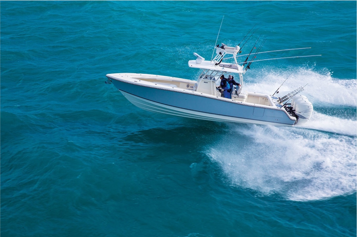
What is a 5-in-1 GPS Chart Plotter?
Navigational technology has seen significant advancements, culminating in the development of the 5-in-1 GPS chart plotter, a device that marries multiple crucial maritime technologies into a singular, streamlined unit. This sophisticated tool is not merely an evolution in marine navigation; it represents a fusion of functionalities crucial for modern seafaring adventures.The Integration of Technologies in One Unit
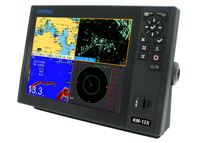
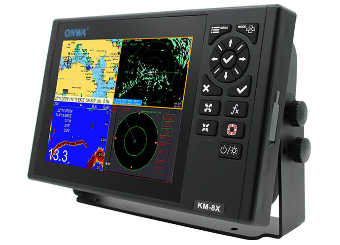
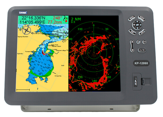
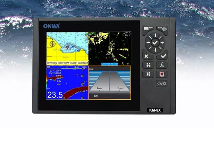
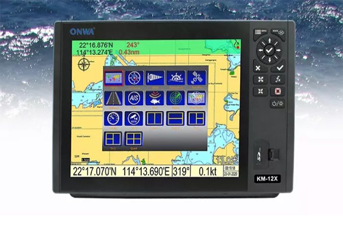
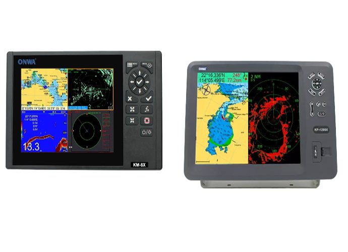
The 5-in-1 GPS chart plotter stands out for its all-encompassing design, integrating five core navigational technologies: GPS plotting for precise location tracking, digital charting for clear map visualization, sonar for depths and fish-finding, AIS transponders for vessel identification, and radar for obstacle detection and collision avoidance. This integration allows for an unparalleled situational awareness, granting mariners the ability to navigate safely and efficiently in diverse maritime conditions.Benefits of Having Multiple Functions in a Single Device
Having a 5-in-1 GPS chart plotter onboard offers substantial benefits, fundamentally enhancing the boating experience by providing:Comprehensive Navigational Insight
With the fusion of GPS, chart plotting, and additional features in a single device, mariners gain a multidimensional view of their surroundings. This comprehensive insight ensures that sailors can make informed decisions, whether they're navigating through tight channels or open waters, under any conditions.Space and Cost Efficiency
Space on a vessel is always at a premium, and the consolidation of multiple functions into one device not only saves valuable dashboard space but also presents a cost-effective solution compared to purchasing separate units. The 5-in-1 GPS chart plotter eliminates the need for multiple screens, cables, and power supplies, simplifying the setup and reducing clutter.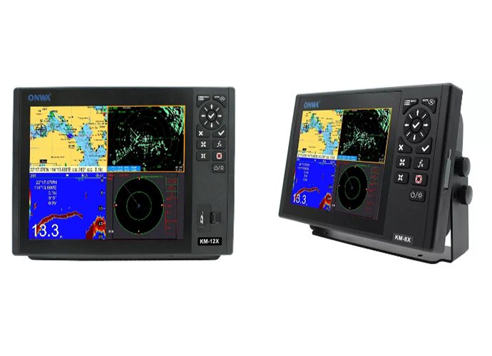
Key Features to Look For in a 5-in-1 GPS Chart Plotter
When hunting for a multi-functional device that ensures superior navigation, one must identify key features a 5-in-1 GPS chart plotter should possess. Dive into these critical components, analyzing their purpose and benefits.Chartplotter with AIS Transponder
A 5-in-1 GPS chart plotter equipped with an Automatic Identification System (AIS) transponder combines the power of chart plotting with advanced vessel identification technology. This transponder broadcasts vessel information such as identity, position, course, and speed to other seafarers, enhancing overall marine safety. The AIS transponder adheres to global maritime safety regulations, making it an indispensable part of any competent chart plotter.GPS Plotter with Echo Sounder
Echo sounders integrated into a 5-in-1 GPS chart plotter offer a significant advantage for fishermen and mariners navigating unfamiliar waters. They provide valuable depth information and help identify fish schools, contributing to successful angling adventures. Their ability to produce accurate seabed images is crucial for determining safe navigational paths and avoiding unforeseen underwater hazards.Analyzing Transducers
The role of a transducer is pivotal in a 5-in-1 GPS chart plotter setup. This device converts electrical signals into sonar or sound waves, facilitating the chart plotter's echo sounding and imaging capabilities. For instance, the transducer used in the ONWA provides high-resolution, accuracy, and detailing in its underwater imaging capabilities, aiding in both navigation and fishing applications.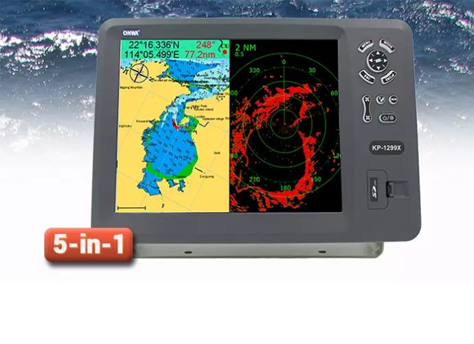
Integrating Your 5-in-1 GPS Chart Plotter with Other Systems
The versatility and efficiency of a marine navigation setup are greatly enhanced when integrating your 5-in-1 GPS chart plotter with other onboard systems. This seamless connectivity not only streamlines your navigation experience but also enables you to leverage the full potential of your maritime electronics.Considering Compatibility for Integration
Before integrating your 5-in-1 GPS chart plotter with other systems, you need to understand the compatibility requirements.Interface and Connectivity
Examine the types of interfaces available on your existing marine electronics. Ensure they match those on the chart plotter, such as NMEA 0183, NMEA 2000, SeaTalk, Ethernet, or Wi-Fi. This will facilitate communication between devices.Software Compatibility
The software version of your 5-in-1 GPS chart plotter should be compatible with other devices. This may require updating the firmware of older systems to ensure seamless integration and data sharing.Power Requirements
Considering the power draw and supply compatibility is essential, as integrating multiple systems will likely increase the overall power consumption.Setting Up Your 5-in-1 GPS Chart Plotter
Setting up your 5-in-1 GPS chart plotter involves a systematic approach. Here is a step-by-step guide to ensure a successful installation.Initial Setup
- Mount the Chart Plotter: Securely mount your 5-in-1 GPS chart plotter in a location that offers optimal visibility and protection from the elements.
- Connect to Power: Provide a stable power connection following the manufacturer’s recommendations to avoid electrical issues.
- Install the Transducer: Mount the transducer according to the instructions, ensuring it's submerged and clear of obstructions for accurate readings.
Integration Process
- Link Auxiliary Devices: Using appropriate cables or wireless connections, link the chart plotter to other electronics like radar, AIS transponders, and autopilot systems.
- Software Configuration: Access the settings menu to recognize and configure connected devices, aligning them with the 5-in-1 GPS chart plotter functionalities.
- Calibration and Testing: Calibrate your instruments to sync accurately with the chart plotter’s readings, testing all connections and ensuring that data flows seamlessly across the systems.
Final Checks
- Review All Connections: Double-check all physical and wireless connections for secure fittings.
- Test on Water: Conduct a trial run to test the system in real conditions.
5-in-1 GPS Chart Plotter Making the Purchase: Price vs. Performance
When considering the acquisition of a 5-in-1 GPS chart plotter, prospective buyers must balance cost-effectiveness with the expected performance. This comprehensive overview provides insights into the value offered by multifunctional units such as Onwa and Simrad Cruise, alongside actionable tips for securing the most advantageous deal that addresses individual maritime needs.Assessing Cost-Effectiveness of 5-in-1 GPS Chart Plotters
The search for a cost-effective 5-in-1 GPS chart plotter entails thorough research and a value comparison of top brands like Onwa and Simrad Cruise.Value for Money
- Feature Set: Evaluate if the features of a 5-in-1 GPS chart plotter, which typically include chart plotting, AIS, echo sounder, GPS, and additional networking capabilities, align with your maritime activities.
- Longevity and Durability: Higher initial costs may be justified for a 5-in-1 GPS chart plotter that promises longevity and is built to withstand harsh marine environments.
Brand Comparison
| Feature/Aspect | Onwa 5-in-1 GPS Chart Plotters | Simrad 5-in-1 GPS Chart Plotters |
|---|---|---|
| Display and Resolution | Depending on model, likely offers standard to high-resolution displays for clear chart plotting. | Known for high-resolution, bright displays which can be visible in direct sunlight. |
| Durability and Waterproofing | Built to be durable with varying levels of waterproofing based on model. | Typically offers high durability with superior waterproof ratings, suitable for all weather conditions. |
| Ease of Use | User interface could be straightforward but varies by model; some models may require a learning curve. | Generally features an intuitive interface with touch-screen and/or button navigation options. |
| Mapping and Charting Capabilities | Varying chart support depending on the model; might offer compatibility with popular charting software. | Often includes preloaded charts with extensive mapping capabilities; possibly more advanced chart updating features. |
| Radar Integration | Capable of integrating with radar systems, but the extent and ease of integration can vary. | Robust radar integration capabilities, often designed for seamless connection with Simrad radar systems. |
| Fishfinder Capabilities | If included, generally suitable for casual to moderate fishing activities. | High-performance fishfinding technology, often with CHIRP and other advanced sonar technologies. |
| Connectivity Options | Basic to moderate; typically includes GPS and may have NMEA connections for networking. | Advanced connectivity, including Wi-Fi, Bluetooth, NMEA 2000/0183, and integration with other onboard systems. |
| Price Range | Generally cost-effective, offering good features for the price. May be more appealing to budget-conscious users. | Higher price range, reflecting advanced features, technology integration, and brand premium. |
| After-Sales Support | Variable; some reports indicate good support, while others suggest room for improvement. | Known for high-quality customer support and extensive dealer network for service and assistance. |
| Overall Technology and Features | Solid basic to mid-range technology and features; suitable for most recreational boating needs. | Advanced technology and cutting-edge features, appealing to serious boaters and professionals seeking top performance. |
Securing the Best Deal on a 5-in-1 GPS Chart Plotter
Capitalizing on the best deal for a 5-in-1 GPS chart plotter involves strategic approaches to shopping for marine electronics.When to Buy
- Off-Season Shopping: Prices may be lower during the off-season or around holidays when sales are common.
- Older Models: When a new model is released, previous versions like an older 5-in-1 GPS chart plotter may be available at a reduced price.
Shopping Smart
- Comparison Shopping: Use online tools to compare prices of 5-in-1 GPS chart plotters across various retailers.
- Warranty and Support: A good deal includes comprehensive customer support and an extensive warranty period, ensuring peace of mind and potential savings on future repairs or issues.
- Bundles and Discounts: Look out for bundle deals where transducers or additional mapping software are included with the purchase of a 5-in-1 GPS chart plotter.
5-in-1 GPS Chart Plotter User Insights
In the pursuit of finding the best 5-in-1 GPS chart plotter for maritime needs, potential buyers often delve into user reviews and professional recommendations. To sift through vast amounts of feedback and distill this data into a useful tool for decision-making is crucial.Collecting Comprehensive User Reviews
User reviews are a goldmine of information for anyone interested in purchasing a 5-in-1 GPS chart plotter. They offer nuanced insights into how the product performs in real-world situations.Review #1: Ultimate Seafaring Companion
Rating:★★★★★Reviewer: Mary
Evaluation Time: 5 months ago
"After months of research and comparison, I decided to equip my catamaran with the ONWA marine satellite TV antenna. The HD capability is a game changer, delivering crystal-clear picture quality even in challenging sea conditions. The compatibility with various satellite providers meant I was free to choose a package that suited my sailing itinerary. What impressed me most, however, was the gyroscopic stabilization feature. It kept the signal steady through some rough passages, ensuring uninterrupted access to my favorite shows and sports broadcasts. ONWA has truly enhanced my family's long voyages, making it feel like a home away from home."Review #2: Navigator’s Delight
Rating: ★★★★☆Reviewer: Alex
Evaluation Time: 2 months ago
purchased the ONWA 5-in-1 GPS chart plotter for my fishing boat, and it has been a solid addition to my gear. The multi-functionality combining GPS, fish finder, radar, and AIS receiver in one unit is impressive. The plotter is very user-friendly, and I was up and running with minimal fuss. The fish finder's sensitivity is excellent, showcasing ONWA’s expertise in marine electronics. My only critique is the screen visibility under direct sunlight could be better. Despite this, it's certainly upped my fishing game."Review #3: Reliable Sea Guide
Rating: ★★★★★Reviewer: Linda
Evaluation Time: 8 months ago
"The ONWA 5-in-1 GPS chart plotter has been a dependable companion on our family’s sailing adventures. The accuracy of the GPS system is top-notch, providing us with confidence in navigation even in unfamiliar waters. The system also integrates seamlessly with our existing marine electronics, which was a huge relief. The inclusion of an autopilot feature has been incredibly beneficial, allowing for more relaxation time on deck. It’s a robust system designed with the end-user in mind."Review #4: Feature-Rich but Complex
Rating:★★★☆☆Reviewer: Brian
Evaluation Time: 1 month ago
"As an avid sailor, I was excited to upgrade to the ONWA 5-in-1 GPS chart plotter. The array of features packed into this device is truly impressive – from detailed chart plotting capabilities to real-time weather updates. However, I've found the learning curve to be steeper than expected. The manual could do with a more detailed explanation of features. New users might find it daunting without prior experience with similar technology. Once you get the hang of it, it's a powerful tool, but it’s not as intuitive as I’d hoped."Review #5: Excellent After-Sales Support
Rating:★★★★☆Reviewer: Susan
Evaluation Time: 3 weeks ago
"My experience with the ONWA 5-in-1 GPS chart plotter has been generally positive, especially highlighting their after-sales support. The device offers robust navigation tools and the quality of the display is fantastic. However, I encountered some issues with software updates. I reached out to ONWA’s customer service, and their responsiveness and willingness to help were outstanding. They walked me through the process, ensuring my chart plotter was back up and running smoothly. It’s reassuring to know that behind a great product is equally great customer support."Interpreting Reviews for an Informed Choice
Making sense of user reviews requires a critical approach to separate helpful insights from noise and bias.Decoding Sentiments
- Objective vs. Subjective: Determine if the feedback is fact-based or opinion-driven. Objective points on the 5-in-1 GPS chart plotter features can be more reliable than subjective viewpoints on aesthetics.
- Specific Scenarios: Reviews that describe specific situations or use cases of the 5-in-1 GPS chart plotter can give you a clearer picture of its functionality and performance in conditions similar to your own.
Considering Context
- Reviewer's Expertise: Consider the reviewer's level of experience and expertise. An amateur sailor’s viewpoint may differ significantly from that of a seasoned mariner.
- Product Evolution: Recognize that reviews may become outdated as software updates and product revisions to a 5-in-1 GPS chart plotter can significantly affect performance and user experience.
>>Click here view more