
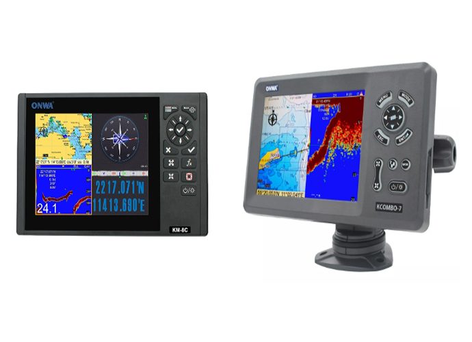
Marine GPS/Marine Plotter/Marine Sounder - Combo Technology
In the vast and ever-changing marine landscape, the advent of the marine GPS/marine plotter/marine sounder - combo represents a significant leap towards modernizing maritime navigation.Defining Marine GPS/Marine Plotter/Marine Sounder - Combo
The marine GPS/marine plotter/marine sounder - combo is an all-in-one device that integrates three essential technologies:- GPS (Global Positioning System): Offers precise geolocation services, pinpointing your exact position in the vast marine environments.
- Marine Plotter: Utilizes GPS data to plot your course on digital maritime charts, providing an interactive navigation experience.
- Marine Sounder: Also known as a fishfinder, it uses sonar technology to deliver vital information regarding the underwater terrain and marine life beneath your vessel.
The Triple Tech Synergy
This combination creates a synergistic effect that enhances marine navigation:- Accuracy and Efficiency: By merging GPS with plotting capabilities, mariners can navigate with unprecedented precision and ease.
- Comprehensive Marine Insights: Adding the sounder into the mix offers a detailed view of the underwater world, crucial for fishing and navigating through difficult waters.
Historical Evolution of Marine Navigation
The journey from using celestial bodies for navigation to relying on sophisticated electronic systems is a testament to human ingenuity:- Ancient Techniques: Started with rudimentary tools and the stars as guides.
- Technological Revolution: Evolved through the ages, incorporating compasses, sextants, and finally, GPS systems, culminating in today’s multifunctional combos.
The Critical Role of Technology Integration
Incorporating advanced technology in maritime navigation isn't just about convenience; it's about enhancing safety, accuracy, and decision-making on the waters:- Safety Measures: Minimizes risks by providing accurate locational and environmental data.
- Efficient Route Planning: Enables optimal route selection, saving time and resources.
Why It’s a Comprehensive Solution
The marine GPS/marine plotter/marine sounder - combo stands as a singular solution for numerous navigational challenges:- All-in-One Device: Reduces clutter and simplifies operations by combining critical navigation functions.
- Versatility: Equally useful for commercial shipping, recreational boating, and fishing expeditions.
- Ease of Use: Intuitive interfaces and integrated functionalities make maritime navigation accessible to novices and experts alike.
Marine GPS/Marine Plotter/Marine Sounder - Combo Key Features
The marine GPS/marine plotter/marine sounder - combo brings together three pivotal technologies to enhance the maritime navigation experience. This powerful fusion not only simplifies the navigational process but also significantly increases safety and efficiency on the water.GPS Functionality
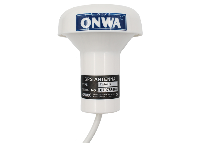
The GPS aspect of a marine GPS/marine plotter/marine sounder - combo is foundational, providing the spatial coordinates that are critical for any form of marine navigation.- Importance of GPS Accuracy and Reliability: High precision in GPS readings ensures mariners can navigate safely, avoiding potential hazards with confidence. The reliability of GPS data, achievable through advanced satellite technology, guarantees that even in adverse weather conditions or uncharted territories, location information remains accurate and trustworthy.
- Benefits of Real-Time Location Tracking: Having access to real-time positioning allows for dynamic navigation adjustments, essential in the ever-changing marine environment. It enables the crew to make informed decisions promptly, whether to avoid imminent weather issues or to adjust sails for optimal speed.
Plotter Capabilities
The plotter component of the marine GPS/marine plotter/marine sounder - combo transforms raw data into a visually understandable format, making navigation more intuitive.- How Electronic Chart Plotters Revolutionize Marine Navigation: Electronic chart plotters have revolutionized navigation by providing a user-friendly interface that overlays GPS location data onto digital marine charts. This integration allows for real-time visual tracking of the vessel’s position against nautical charts, enhancing situational awareness and decision-making on the water.
- Discussing Chart Options: From Pre-loaded to Downloadable: Modern plotters offer a range of chart options, from pre-loaded charts tailored to specific regions to downloadable updates that ensure the most current map data is at the navigator's fingertips. This flexibility allows mariners to plan for trips in different waters seamlessly, ensuring they are always equipped with accurate navigational aids.
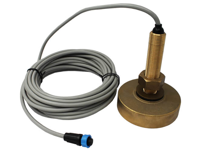
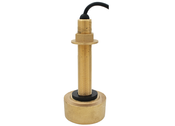
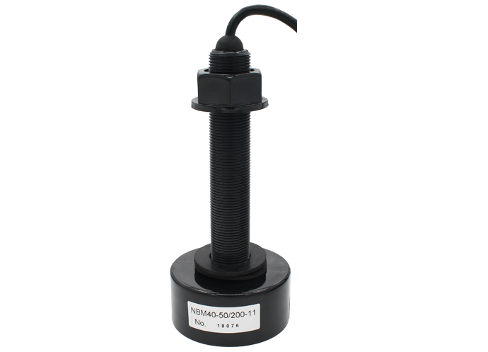
Sounder/Sonar Features
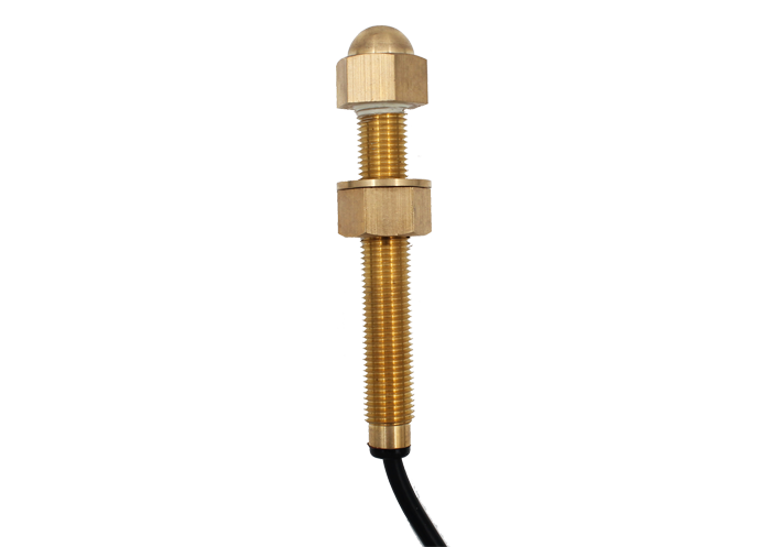
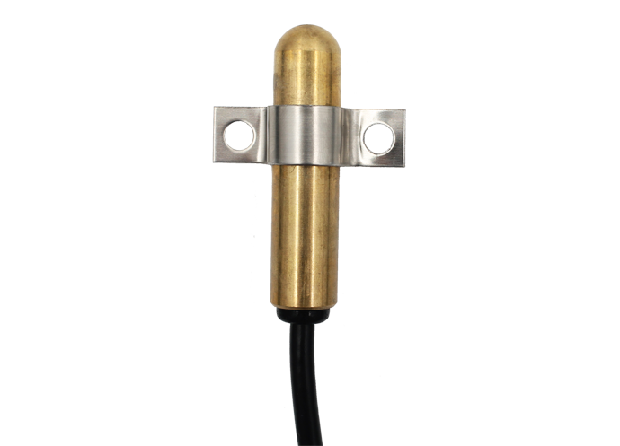
The sounder or sonar functionality enriches the marine GPS/marine plotter/marine sounder - combo by providing in-depth knowledge of the underwater landscape.- Explanation of How Sounders Work and Their Significance: Sounders operate by emitting sound waves downward into the water. The waves bounce back upon encountering the sea floor or other objects, with the return time indicating depth and potential obstructions. This information is crucial for avoiding underwater hazards and for fishing activities, giving insight into the seabed's composition and locating fish schools.
- Detailing Different Types of Sonar Technologies (e.g., CHIRP, SideVu): Various sonar technologies offer different advantages. CHIRP (Compressed High-Intensity Radar Pulse) sonars provide greater depth penetration and resolution, making it easier to distinguish between small targets in deep water. SideVu technology offers detailed images of the sea floor to the sides of the vessel, expanding the covered area for comprehensive underwater imaging.
Best Marine GPS/Marine Plotter/Marine Sounder - Combo - Buyer’s Guide
Navigating the waters is intricate and demanding, but choosing the best marine GPS/marine plotter/marine sounder - combo doesn't have to be.Criteria for Selection
Selecting the right marine GPS/marine plotter/marine sounder - combo involves more than just picking the most popular brand or the one with the most features. Here's what matters:- Ensuring Accuracy and Reliability: The primary function of any navigational system is to provide accurate and reliable data. Look for systems known for their precision and consistency, especially in varying marine environments.
- Integration and Compatibility: A seamless integration of GPS, chart plotting, and sounder technologies is crucial. Compatibility with various sensors and systems on your vessel also ensures a smooth operation.
- Durability and Waterproofing: Marine electronics are exposed to harsh conditions, so durability and waterproofing are non-negotiable for longevity and safety.
Overview of Top Picks
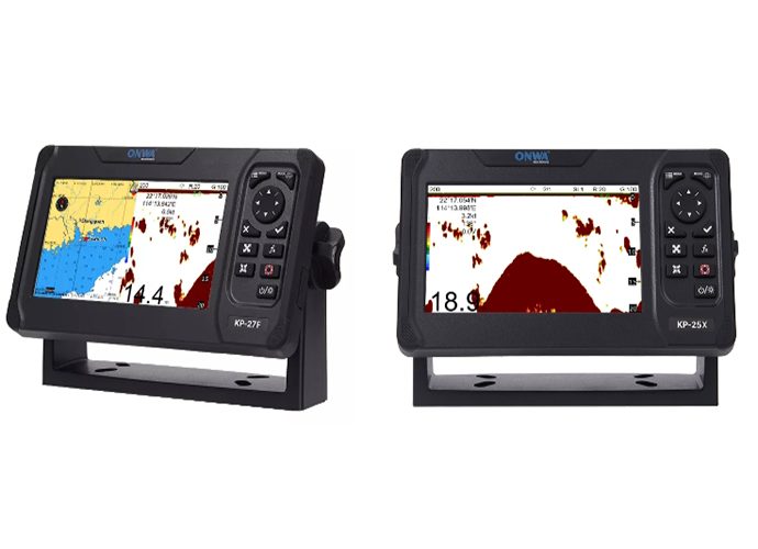
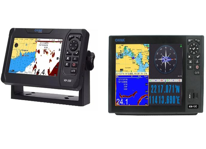
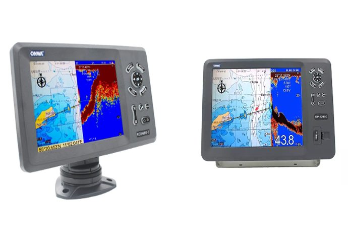
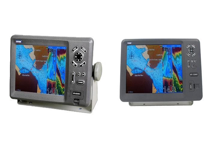
Choosing a top-tier marine GPS/marine plotter/marine sounder - combo starts with knowing the best the market has to offer:- Brand Reputation and Reviews: Companies like ONWA have established themselves as reliable manufacturers. Reviews can also provide real-world insight into how these devices hold up in action.
- Latest Models and Features: Each year, manufacturers roll out new models with advanced features. It's worth looking at the latest releases to see how new improvements align with your navigational needs.
Key Factors to Consider
When sifting through the options for a marine GPS/marine plotter/marine sounder - combo, there are several key factors to keep in mind:- Screen Size and Clarity: A larger, high-resolution screen can make reading charts and sonar returns much easier, especially in bright sunlight or from a distance.
- Connectivity Options: In a world that's more connected than ever, having a system that offers options like Bluetooth, Wi-Fi, and NMEA networking can be pivotal for system integration and updates.
- Ease of Use: The best navigational system is one that you can use intuitively under stress. User-friendly interfaces, responsive touchscreens, and easy-to-navigate menus are all important.
- Additional Functionalities: Extra features such as AIS (Automatic Identification System) integration, radar compatibility, and enhanced sonar image technology can significantly boost the value of the unit.
Using Marine GPS/Marine Plotter/Marine Sounder - Combo: Practical Tips
Navigating the marine world with maximum efficiency and safety requires a deep understanding of your marine GPS/marine plotter/marine sounder - combo. From setting up your new device, and maintaining its accuracy and reliability, to tackling common issues, we will provide you with the practical insights needed to master this advanced and multifunctional tool.Step-by-Step Guide on Setting up Your Device
Getting the most from your marine GPS/marine plotter/marine sounder - combo begins with a proper setup:- Unboxing and Inspecting: Start by checking the device and accessories for any signs of damage during shipment. Make sure that all items listed on the packaging are included.
- Reading the Manual: Thoroughly read the user manual before starting the setup. Each manufacturer and model has a unique installation process and features.
- Software Updates: After mounting and turning on the device, check if there's a newer software version available. Regular updates enhance performance, resolve bugs, and may introduce new features.
Best Practices for Maintaining Accuracy and Reliability
To ensure the ongoing precision and reliability of the marine GPS/marine plotter/marine sounder - combo:- Regular Calibration: Regular calibration of the GPS ensures it delivers accurate positional data. Similarly, keep your sounder tuned correctly based on the sea condition and the vessel's speed.
- Avoid Interference: Avoid installing the unit too close to other electronic devices to prevent electromagnetic interference which can impact GPS accuracy and sonar readings.
- Periodic Cleaning: Regular cleaning of the device keeps it free from salt and other deposits that might affect its performance over time.
Troubleshooting Common Issues
Every device encounters issues, but the marine GPS/marine plotter/marine sounder - combo is designed to withstand most:- Loss of GPS Signal: Ensure the GPS antenna is unobstructed and not damaged if you're frequently losing signal.
- Inaccurate Chart Plotter Readings: If the chart plotter isn’t accurately reflecting the boat’s GPS position, check if the chart data is up-to-date and correctly calibrated.
- Incorrect Sounder Readings: Unusual sounder readings could be due to incorrect settings, interference from other electronics or even a dirty or damaged transducer. Check these potential issues before considering more serious problems.
Marine GPS/Marine Plotter/Marine Sounder - Combo Special Considerations
When it comes to navigating the open waters, the right equipment can make all the difference. Choosing a marine GPS/marine plotter/marine sounder - combo requires careful consideration of your specific needs, boat size, and the type of boating you plan to do.Marine GPS for Small Boats
Small boats have unique needs that call for careful selection of a marine GPS/marine plotter/marine sounder - combo. How to tailor your choice to your vessel and highlight the advantages of portability and ease of installation.- Tailoring Your Choice: The compact size and limited console space on small boats mean that every piece of equipment must be chosen with care. A marine GPS/marine plotter/marine sounder - combo that is designed for smaller vessels often comes in a more compact form, offering high functionality without taking up excessive space.
- Benefits of Portability and Ease of Installation: For small boats, especially those that are trailered or might not always be in the water, portability becomes a significant advantage. A device that is easy to install and remove can provide the flexibility needed. Additionally, portable units are ideal for renters or those who might switch boats often.
Marine Chartplotter Only vs. Combos
Understanding when a chartplotter-only device may be more advantageous than a combo unit is key to making an informed decision. Here, we compare standalone devices to integrated combos for specific uses.- When a Chartplotter-Only Device Might Be Right: If your primary need is navigation and you rely on separate, specialized equipment for fishing or other activities, a chartplotter-only device might serve your purposes better. These devices are typically simpler, focusing on navigation without the added complexity of integrating a sounder.
- Comparing Standalone Devices to Integrated Combos: While standalone chart plotters are simpler, an integrated marine GPS/marine plotter/marine sounder - combo can offer greater functionality in a single package. This not only saves space but can also provide cost savings over purchasing separate units. For boaters who need both navigation and fish-finding capabilities, a combo unit is often the more convenient and efficient choice.
Marine GPS/Marine Plotter/Marine Sounder - Combo Application and Innovation
The marine GPS/marine plotter/marine sounder - combo has evolved significantly from basic navigation aids to sophisticated systems that provide comprehensive maritime data. This growth has been significantly influenced by the development of innovative apps and software, alongside the anticipation of future trends in marine navigation technology.Overview of Innovative Apps and Software Enhancing Functionality
The integration of innovative applications and software has transformed the utility of the marine GPS/marine plotter/marine sounder - combo, making it an indispensable tool for mariners:- Advanced Charting Apps: Modern software solutions offer detailed and dynamic charting capabilities, providing users with real-time updates on water depth, obstacles, and even weather conditions. These apps enhance situational awareness and improve safety at sea.
- Fish Finder Technologies: For anglers, the integration of sophisticated fish finder apps that interpret sonar data to pinpoint fish locations with remarkable accuracy has been game-changing. These applications utilize complex algorithms to differentiate between fish types, sizes, and depths, making them a critical tool for any fishing expedition.
- Integration with Mobile Devices and Wearables: The ability to sync marine GPS/marine plotter/marine sounder - combo systems with smartphones, tablets, and even smartwatches enhances flexibility in navigation and data sharing. Mariners can receive notifications, plot courses, and view sonar data directly on their mobile devices.
Future Trends in Marine Navigation Technology
Looking ahead, the future of marine navigation technology promises even more sophisticated, integrated, and user-friendly innovations:- Augmented Reality (AR) Integration: AR technology is expected to play a significant role in the advancement of marine navigation. By overlaying navigational data and real-time information directly over the live view of the surroundings, AR can enhance situational awareness and aid in precise navigation, especially in challenging conditions.
- Autonomous Navigation Systems: With the trend toward automation in various sectors, autonomous navigation systems for marine vessels are in development. These systems would not only plan and plot courses using the marine GPS/marine plotter/marine sounder - combo but also take active control of the vessel to follow these paths safely, adjusting to real-time maritime conditions.
- Increased Connectivity and Cloud-Based Data: Future marine navigation systems are likely to incorporate greater connectivity options, enabling the seamless exchange of data between vessels and between ships and shore-based systems. Cloud-based data storage and sharing will facilitate up-to-date charts, navigational aids, and even crowd-sourced marine data accessible from anywhere.
>>Click here view more