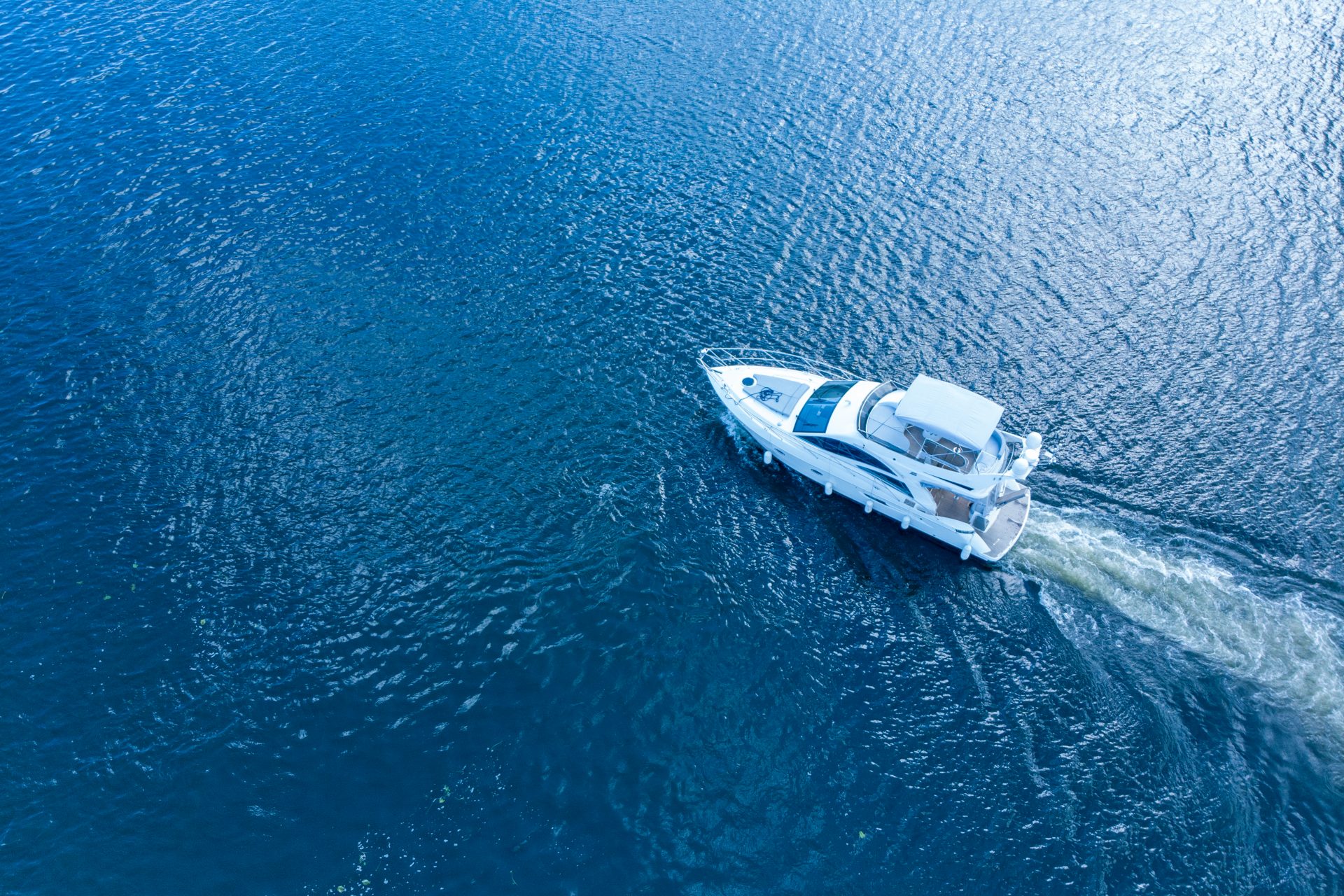
The quest for the best marine tablet GPS chartplotter has intensified as mariners increasingly rely on digital navigation tools to enhance safety and efficiency at sea. GPS chartplotters, especially those designed for marine environments, have become indispensable due to their precision and reliability in mapping and routing. As technology has advanced, so has the evolution of tablet chartplotters, which now offer robust features packed into portable, user-friendly devices. These tools have rapidly gained popularity among sailors, fishermen, and maritime enthusiasts, who appreciate the integration of cutting-edge navigation technology with the convenience and accessibility of a tablet. This integration ensures that the best marine tablet GPS chartplotter not only meets the rigorous demands of marine navigation but also aligns with the modern mariner’s expectations for technology and performance.
Criteria for Choosing the Best Marine Tablet GPS Chartplotter
When selecting the best marine tablet GPS chartplotter, it’s crucial to consider several key features that enhance functionality, usability, and reliability in marine environments. Here, we detail the essential criteria to guide you in choosing a device that meets your navigational needs on water.
Key Features to Look for in a Marine Tablet GPS Chartplotter
- Waterproofing: The marine environment is harsh, and electronic devices are vulnerable to water damage. A high-quality marine tablet GPS chartplotter must be waterproof, ideally meeting IPX7 or higher waterproof standards, which means it can withstand incidental exposure to water of up to 1 meter for up to 30 minutes.
- GPS Functionality: Core to its purpose, the GPS functionality must be exceptionally accurate and reliable. Look for devices that offer quick GPS lock times and support for multiple satellite systems like GPS, GLONASS, or Galileo for enhanced accuracy and reliability.
- Durability: Marine tablets need to be built to withstand not only water but also salt, wind, and sun exposure. Materials that resist corrosion, UV damage, and can handle being dropped or knocked about are essential.
- Sunlight Readability: The screen should be readable in direct sunlight. Opt for tablets with bright, anti-reflective displays to ensure clear visibility even on bright days.
- Battery Life: Long battery life is crucial for extended trips. Look for a tablet that offers long battery life or options for easy onboard charging.
- Rugged Design: Apart from being waterproof, the marine chartplotter tablet should also feature a rugged design to withstand the rigors of marine use, including shock and vibration resistance.
Importance of Built-in GPS Functionality Without Internet Connectivity
The ability of a marine tablet GPS chartplotter to function effectively without internet connectivity is a game-changer. Relying on internet-based maps can be problematic in remote marine areas where internet service is unreliable or unavailable. A built-in GPS that operates independently of internet connectivity ensures that you can access critical navigational data regardless of your location. This feature is indispensable for safety and convenience, allowing for continual tracking and updates of your position, which is essential for planning routes, avoiding hazards, and maintaining awareness of your surroundings while at sea.
Choosing the best marine tablet GPS chartplotter involves careful consideration of these features. Ensure that your chosen device integrates these elements seamlessly to provide reliable, efficient, and safe navigation in all marine conditions.
Best Marine Tablet GPS Chartplotter for 2023
Top Tablets for Marine Navigation in 2023
Navigating the vast selection of marine technology, this section highlights the best marine tablet GPS chartplotter options available in 2023. Each tablet has been selected based on its suitability for marine environments, feature set, and user reviews.
- Best Overall Marine Tablet GPS Chartplotter
The top-rated tablet in this category excels in both functionality and durability, equipped with high-precision GPS and pre-loaded marine charts. Features include waterproof and sunlight-readable displays, long battery life, and integrated marine apps. Pros are its high-speed processing power and excellent GPS accuracy. Cons might be its higher price point and a heavier build compared to less rugged models. - Best Budget-Friendly Marine Tablet
For mariners seeking a reliable but affordable chartplotting solution, this tablet offers a great balance of cost and functionality. Highlights include decent processing power, essential GPS features, and compatibility with popular marine apps. Although it lacks some of the high-end features, its affordability makes it an excellent entry-level option for casual boaters. - Best Marine Tablet for Fishing
Tailored specifically for anglers, this tablet integrates sonar capabilities to help locate fish and map underwater structures. It often includes features like water depth indicators, fish alarms, and real-time weather updates. Its rugged design ensures it can withstand splashes and occasional drops, making it an invaluable tool for any fishing expedition. - Best 7-inch Tablet for Marine Navigation
Perfect for personal use or small vessels, this compact tablet packs all the necessary features into a 7-inch display. It is often chosen for its portability, ease of mounting in tight spaces, and its ability to function seamlessly with GPS-enhanced marine charts. Despite its smaller size, it doesn’t compromise on the clarity and responsiveness of the touchscreen. - Best Rugged Tablet for Off-Road and Marine Use
This category focuses on tablets that can handle both marine and terrestrial environments. These are typically MIL-STD certified for impact resistance and come with IP ratings for water and dust resistance. Ideal for mariners who also engage in off-road activities, these tablets ensure that no matter the environment, navigation and connectivity remain uninterrupted.
Each of these tablets has been evaluated to ensure they meet the high standards required by today’s mariners, making them worthy contenders for the title of the best marine tablet GPS chartplotter in 2023. Whether you are fishing, cruising, or engaged in rigorous marine activities, there is a tablet designed to meet your navigational needs.
Special Mention: Free Chartplotter Apps for the Best Marine Tablet GPS Chartplotter
When exploring options for the best marine tablet GPS chartplotter, it’s beneficial to consider not only the hardware but also the software capabilities that enhance marine navigation. Free chartplotter apps play a pivotal role in providing accessible navigation solutions that are easy to use and update. This section provides an overview of free chartplotter apps available for download and their compatibility with various tablets, enhancing the functionality of your marine GPS device.
Overview of Free Chartplotter Apps
Free chartplotter apps are an excellent resource for boaters who need reliable navigation tools without the added cost of premium software. These apps typically offer a range of features that are essential for safe and efficient navigation, including:
- Map Overlays: Most apps provide detailed chart overlays that show underwater hazards, buoys, and other critical marine information.
- Route Planning: Users can plot and save routes, helping to plan trips efficiently.
- Real-Time GPS Tracking: Even in the absence of internet connectivity, these apps can use the tablet’s built-in GPS to track real-time movements.
- Community Updates: Some apps include features that allow users to share updates or corrections to charts, ensuring more accurate navigation data.
Compatibility with various tablets is crucial for maximizing the utility of free chartplotter apps. The marine chartplotter tablet will support multiple operating systems, including Android, iOS, and sometimes Windows, allowing a broader range of users to benefit from the apps. It’s important to check the specific requirements for each app, as some may only be optimized for newer versions of these operating systems or specific tablet models.
When selecting the best marine tablet GPS chartplotter, consider the availability and features of free chartplotter apps. These apps can significantly enhance your navigation experience, offering a cost-effective alternative to more expensive proprietary software. Make sure that the tablet you choose is compatible with a wide range of apps to ensure flexibility and up-to-date navigation capabilities.
User Recommendations and Reviews for the Best Marine Tablet GPS Chartplotter
In the quest to find the best marine tablet GPS chartplotter, user recommendations and reviews provide invaluable insights that go beyond technical specifications and marketing claims. They offer real-world feedback on how these devices perform under various marine conditions and the overall user experience with different chartplotter apps. This section compiles opinions from experienced users across multiple platforms, including Reddit and specialized marine forums, focusing on real-world performance and user satisfaction.
Compilation of User Opinions and Experiences
The user reviews are gathered from eight individuals who actively participate in marine activities and use their tablets for navigation. These users share their experiences on platforms like Reddit, marine blogs, and online forums dedicated to boating and sailing. The feedback covers a range of aspects:
- Device Reliability: Users often discuss how reliable their marine tablets are in harsh conditions, including their waterproof and sunlight-readable features.
- GPS Accuracy: Opinions frequently highlight the accuracy of GPS functionality in remote areas, crucial for navigating tricky waters.
- App Usability: Reviews also delve into the user interface and usability of various free and paid chartplotter apps, noting which ones offer intuitive navigation aids.
- Compatibility Issues: Some reviews point out compatibility challenges between certain tablets and popular navigation apps, which can be crucial for potential buyers.
Discussion on Real-World Performance in Different Marine Conditions
The real-world performance of these tablets and their accompanying apps is assessed under nine different marine conditions, including high seas, coastal waters, and shallow inland water bodies. Users report on several key factors:
- Signal Strength in Remote Areas: Many users note the performance of the GPS signal when far from usual cellular or Wi-Fi networks.
- Durability in Saltwater Environments: Feedback often includes how well the devices hold up against corrosion or exposure to saltwater.
- Battery Life During Extended Use: Essential for long trips, users share their experiences regarding battery longevity under continuous use.
- Screen Visibility Under Various Lighting: Reviews frequently mention how readable displays are under bright sunlight or during overcast conditions.
This comprehensive view from actual users provides prospective buyers with a deeper understanding of what to expect from the best marine tablet GPS chartplotter in various settings. These insights help ensure that users select a device that not only meets their technical requirements but also stands up to the practical challenges of marine navigation.
Guide to Setup and Usage of the Best Marine Tablet GPS Chartplotter
Setting up and using the best marine tablet GPS chartplotter effectively can transform your boating experience by providing reliable and precise navigation. This guide offers a detailed, step-by-step approach to setting up your tablet as a GPS chartplotter and includes tips to optimize GPS accuracy and ensure reliability during navigation.
Step-by-Step Guide on Setting Up Your Tablet as a GPS Chartplotter
- Selecting the Right Tablet: Choose a tablet with robust GPS capabilities, good battery life, and durability. Ensure it is waterproof or has a protective case suitable for marine environments.
- Installing Navigation Apps: Download and install your chosen chartplotter apps from the app store. Consider apps that are highly recommended in marine forums for their reliability and comprehensive features.
- GPS Configuration: Activate the GPS function in your tablet’s settings. Disable other location services that rely on Wi-Fi or mobile networks to ensure that the GPS operates in a standalone mode.
- Downloading Maps: Download offline maps or charts for the areas you plan to navigate. Ensure these maps are stored locally to be accessible without internet connectivity.
- Mounting the Tablet: Securely mount the tablet on your vessel in a location that is both visible and protected from direct exposure to the elements like heavy sunlight or water.
- Power Management: Connect your tablet to a reliable power source. Consider using a marine-grade USB charger to handle fluctuations in power supply and prevent damage.
- Calibrating the Compass: Many apps require compass calibration for accurate heading information. Follow the app’s instructions to calibrate the compass away from any magnetic interference.
- Testing Before Departure: Before setting off, test the setup in a variety of conditions to ensure everything works as expected. Check GPS accuracy, app functionality, and map clarity.
Tips on Optimizing GPS Accuracy and Ensuring Reliability During Navigation
- Keep Software Updated: Regularly update your navigation apps and tablet operating system to utilize the latest enhancements and security patches.
- Clear View of the Sky: Ensure that your tablet has an unobstructed view of the sky to improve GPS signal reception. Avoid placing it near objects that could block the signal, such as heavy equipment or inside closed compartments.
- Use External GPS Antennas: For enhanced accuracy, consider using an external GPS antenna, especially if your tablet’s internal GPS is suboptimal or if you frequently navigate areas with poor satellite visibility.
- Battery Conservation Settings: Adjust your tablet’s settings for optimal battery use without compromising GPS functionality. Dim the screen brightness and close unnecessary apps running in the background.
- Regular GPS Tests: Conduct regular tests to check the GPS accuracy. Use known locations to see if the readings are precise and consistent.
- Avoid Heat and Water Exposure: Protect your tablet from excessive heat and direct water exposure, as these can affect performance and lead to hardware failures.
- Network Settings: While using standalone GPS is recommended, ensure your network settings are configured correctly for emergency situations where you might need internet access.
- User Community Feedback: Participate in forums and read reviews from other users to learn about their setups and tweaks to improve GPS performance and reliability.
By following this comprehensive guide to setup and usage, you can maximize the efficiency of your best marine tablet GPS chartplotter, ensuring safe and accurate navigation across diverse marine environments.
Future of Marine Navigation Tablets with the Best Marine Tablet GPS Chartplotter
As technology continues to advance, the future of marine navigation tablets holds exciting possibilities for enhancing safety, efficiency, and user experience on the water. This section explores innovations in tablet technology that could revolutionize marine navigation and highlights emerging trends to look forward to in the next few years.
Innovations in Tablet Technology for Marine Navigation
- Improved GPS Accuracy: Future marine tablets may feature advanced GPS technologies such as multi-frequency receivers and real-time kinematic (RTK) positioning, providing even greater accuracy and reliability in determining vessel position.
- Augmented Reality (AR) Navigation: AR-enabled marine tablets could overlay navigational data onto live camera feeds, offering intuitive and immersive navigation aids that enhance situational awareness and simplify route planning.
- Integration with IoT Devices: Seamless integration with Internet of Things (IoT) devices on board vessels could enable marine tablets to gather and display real-time data from sensors such as weather stations, depth sounders, and engine monitors, providing comprehensive situational awareness to captains and crew.
- Artificial Intelligence (AI) Assistance: AI-powered features such as predictive analytics and adaptive route planning could help optimize navigation routes based on factors like weather conditions, vessel performance, and fuel efficiency, improving voyage planning and safety.
- Wireless Connectivity Standards: Future marine tablets may adopt emerging wireless connectivity standards such as 5G and Wi-Fi 6, enabling faster data transmission, enhanced network reliability, and seamless integration with shore-based services and cloud-based applications.
- Enhanced Durability and Ruggedness: Continued advancements in materials science and manufacturing techniques could lead to marine tablets that are even more rugged, durable, and resistant to environmental factors such as water, shock, and extreme temperatures.
- Expanded Ecosystem of Navigation Apps: An increasing number of specialized navigation apps tailored to specific maritime activities and regions could become available, offering users a wider range of options for chartplotting, weather forecasting, AIS tracking, and other essential functions.
- Customization and Personalization: Future marine tablets may offer greater customization and personalization options, allowing users to tailor their navigation interfaces, data displays, and alert settings to suit their individual preferences and workflow.
Emerging Trends and What to Look Forward to in the Next Few Years
- Integration with Wearable Devices: Integration with wearable devices such as smartwatches and head-mounted displays could provide captains and crew with hands-free access to navigational information and alerts, enhancing safety and convenience on board.
- Environmental Sustainability: Marine tablets of the future may incorporate eco-friendly materials and energy-efficient components to minimize their environmental impact, aligning with growing industry trends towards sustainability and conservation.
- Blockchain-based Navigation Data: Blockchain technology could be used to securely store and distribute navigational data, ensuring data integrity, traceability, and reliability, particularly in decentralized or peer-to-peer navigation systems.
- Autonomous Navigation Systems: Advancements in autonomous navigation systems could enable marine tablets to function as integral components of unmanned or autonomous vessels, providing real-time monitoring, control, and decision support capabilities.
- User-Centric Design: Future marine tablets may prioritize user-centric design principles, focusing on intuitive interfaces, streamlined workflows, and ergonomic form factors to enhance usability and user satisfaction in demanding maritime environments.
- Global Collaboration and Standardization: Increased collaboration among industry stakeholders and standardization of data formats, communication protocols, and interoperability standards could foster greater compatibility and integration between marine tablets and other onboard systems and equipment.
- Enhanced Safety Features: Marine tablets of the future may incorporate advanced safety features such as collision avoidance systems, emergency response planning tools, and geofencing capabilities to mitigate risks and improve situational awareness for mariners.
- Regulatory Compliance and Certification: Regulatory bodies and industry associations may develop standardized testing, certification, and compliance frameworks for marine tablets to ensure their reliability, accuracy, and conformity to international standards and regulations.
By staying abreast of these innovations and emerging trends, users can anticipate the evolution of marine navigation tablets and make informed decisions when selecting the best marine tablet GPS chartplotter to meet their present and future navigational needs.
FAQs about Best Marine Tablet GPS Chartplotter
Can I use a tablet as a marine GPS?
Yes, a tablet can be used as a marine GPS, provided it has the necessary features to support marine navigation apps like Navionics. To effectively use a tablet as a marine GPS, it should have an integrated GPS module that works independently of cellular signals, ensuring accurate location tracking even in remote waters. Besides, a good marine GPS tablet should be water-resistant or housed in a waterproof case to protect it against marine environments. Employing a tablet for navigation also gives the flexibility to use a variety of apps that provide updated charts, weather reports, and additional sailing data, which are beneficial for a comprehensive marine navigation setup.
What tablet do I need to run Navionics?
To run Navionics effectively, you need a tablet that operates on either Android or iOS platforms. Navionics is compatible with devices running Android OS 7.0 and above or iOS 13.0 and higher. The device should have a sufficient processor and RAM to handle the app’s functionality smoothly and prevent lagging or crashing, especially crucial in navigation. It’s also important that the tablet has a built-in GPS chip to ensure the app can function in regions without cellular service. For a better viewing experience, choose a tablet with a larger screen and high resolution. This improves the readability of maps and charts, particularly under bright sunlight.
Which tablet has the best GPS?
For marine navigation, the best tablets are those that offer precise and reliable GPS functionality. The iPad models with cellular capabilities (not the WiFi-only models) have built-in GPS which can be very effective for navigation. Similarly, high-end Android tablets like the Samsung Galaxy Tab S7+ also come with integrated GPS and are known for their accuracy and reliability. When choosing a tablet for marine GPS purposes, ensure the device’s GPS is capable of operating independently without internet connectivity, providing continuous location tracking crucial for precise marine navigation.
Can a tablet be used as a GPS?
Absolutely, a tablet can be used as a GPS device. Many modern tablets come equipped with built-in GPS modules that provide standalone GPS functionality, meaning they don’t require an internet connection to offer precise positioning and navigation assistance. This feature is particularly valuable in remote or rural areas where cellular networks are sparse or nonexistent. Tablets offer larger screens for easy map and navigation tool viewing, a significant advantage over traditional GPS devices. However, when using a tablet as a GPS, especially in a vehicle or outdoors, ensure that it is mounted securely and kept charged, and consider using a rugged case to protect against bumps or drops.