Types of 4-in-1 Chart Plotters

Benefits of 4-in-1 Chart Plotters

The integration of multiple navigational tools into one device has given rise to the 4-in-1 chart plotters, a system that revolutionizes navigation for seafarers. The advantages of such a system cover a wide range of aspects from operational to financial, proving invaluable, especially for operators of smaller vessels.
Popular 4-in-1 Chart Plotters

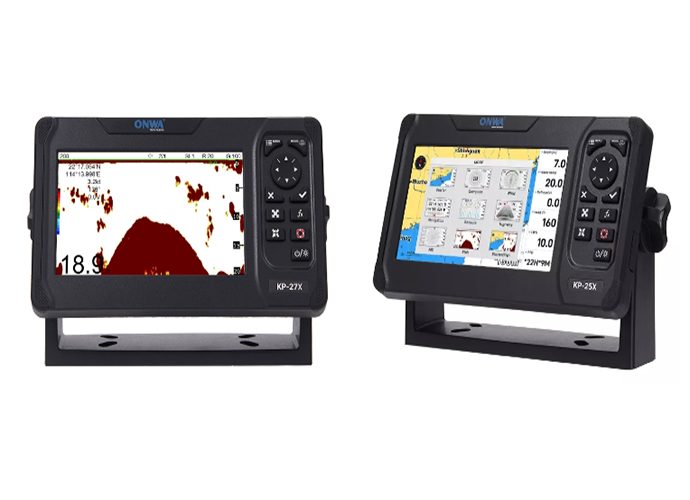
Enhanced Navigational Safety

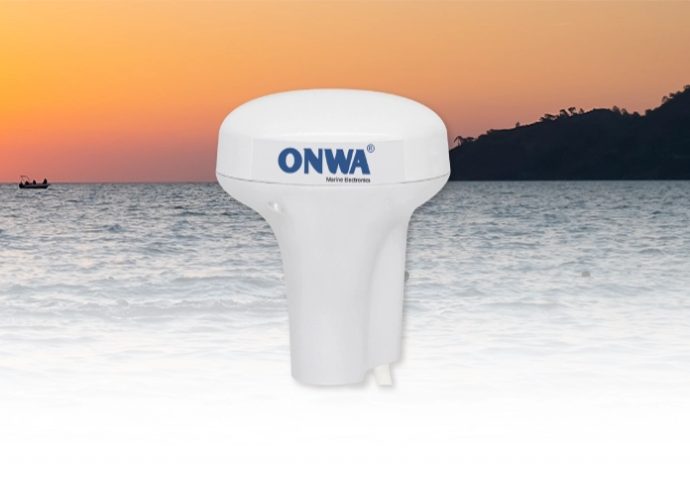
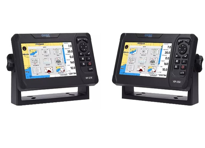
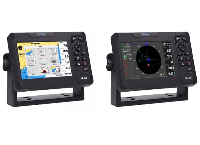
  • Integrated Systems: Combines GPS, sonar, radar, and AIS in one device for a full spectrum of navigational data.
  • Real-Time Information: Offers up-to-the-minute positioning and environmental details essential for making informed decisions at sea.
  • Reduced Risk: Minimizes the chance of navigational errors by providing accurate and comprehensive data from combined technologies.

Maximizing Cockpit Space

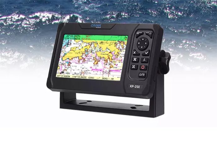
  • Single Unit Design: Occupies less room by incorporating various functions into one compact chart plotter.
  • Decluttered Work: Keeps the helm more organized and free of unnecessary equipment, enhancing focus and control.
  • Optimal Usability: Ensures all navigational tools are accessible from one point, simplifying the user experience.

Economic Advantages

  • Cost Savings: Eliminates the need to invest in multiple separate devices, making it a more budget-friendly option.
  • Streamlined Installation: Requires setting up only one system instead of multiple, saving on installation expenses.
  • Maintenance Efficiency: Simplifies upkeep as there's only one system to maintain and update, reducing long-term servicing costs.
These points succinctly articulate the core benefits of employing a 4-in-1 chart plotters, spotlighting its critical role in enhancing maritime navigation through compact design, increased safety, and cost-effective operation.

Key Features of 4-in-1 Chart Plotters

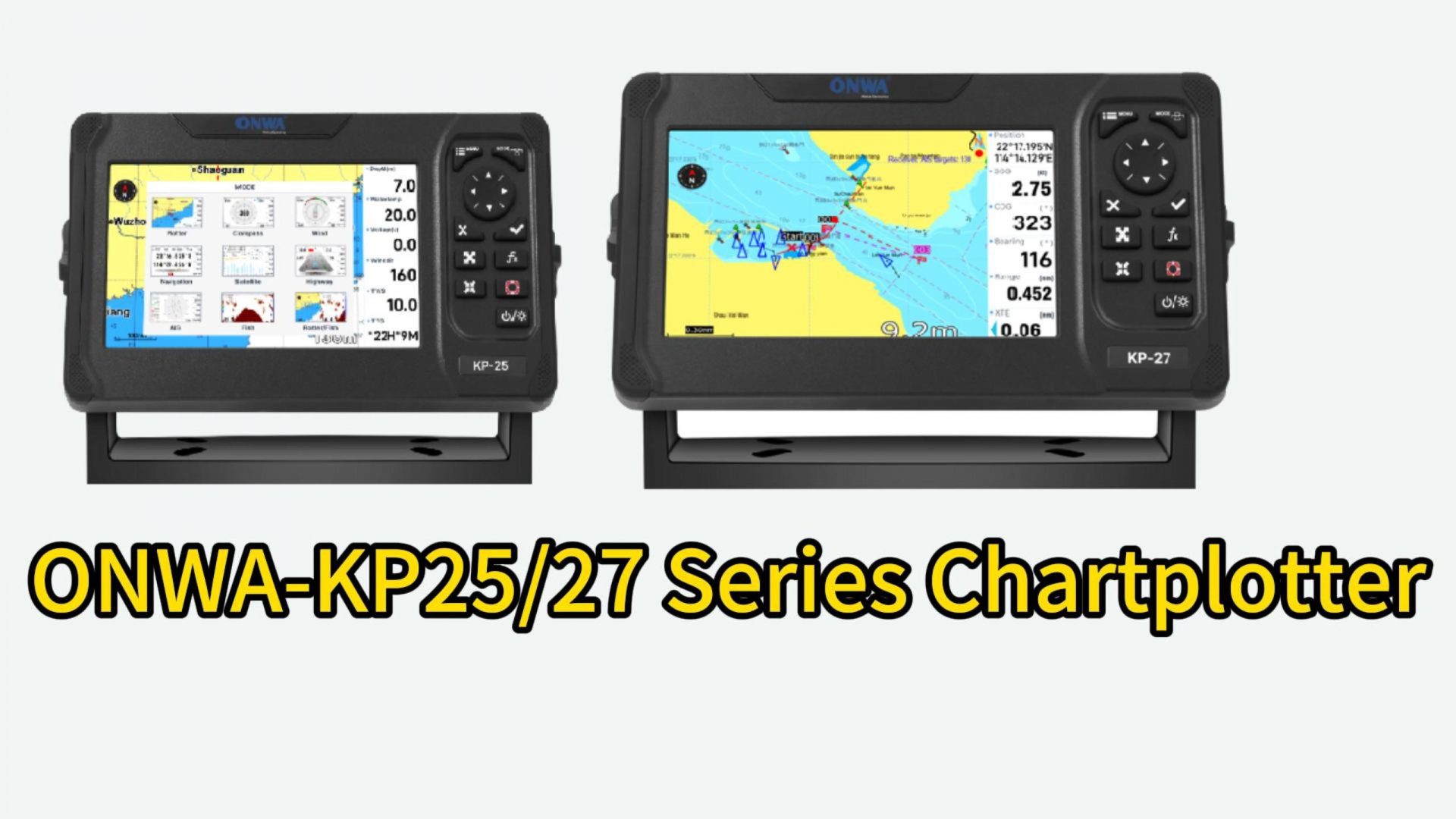
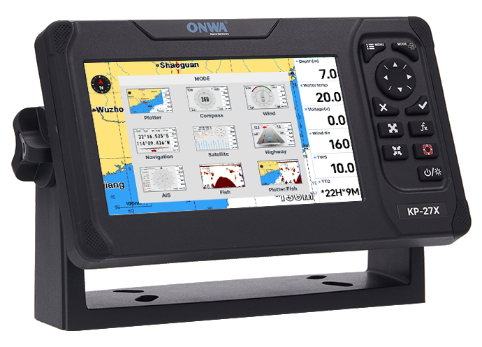
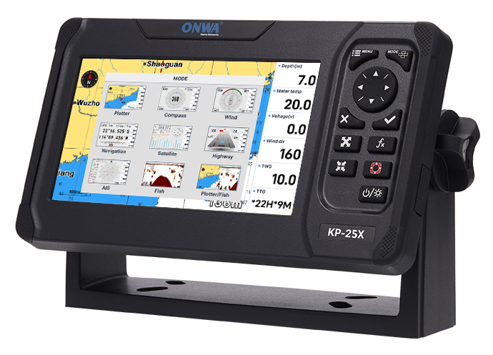
The 4-in-1 chart plotters are leading the way in maritime navigation technology, offering a suite of features that underscore their importance for modern seafarers. These devices not only pinpoint location with precision but also bring a wealth of information and functionality to the helm, enhancing safety, and making navigation more intuitive than ever. 

Touchscreen Interface

  • Ease of Use: The inclusion of a touchscreen interface in chart plotters devices has transformed user interaction, allowing for quick and intuitive access to navigation data and functions.
  • Quick Decision-Making: By facilitating effortless adjustments and real-time data access, touchscreen interfaces support prompt decision-making in changing marine environments.

Compatibility with Older Models

  • Upgrade Path: For those transitioning from ONWA chartplotter older models, the latest 4-in-1 devices offer a significant technological leap, compatible with existing setups while providing advanced features.
  • Enhanced Functionality: Upgrading introduces mariners to improved accuracy, faster processing, and expanded capabilities, such as integrated sonar and radar functionalities.

Online Integration

  • Real-Time Updates: The capacity for online integration ensures that mariners using a chart plotters can access the latest charts, maritime conditions, and software updates in real-time, keeping them informed and prepared.
  • Enhanced Navigation: This connectivity supports better route planning and adaptability to changing conditions at sea, directly contributing to safer voyages.

Radar Combo

  • Safety in Visibility: The ONWA chartplotter radar combo feature drastically enhances navigational safety by providing detailed images of surroundings, especially beneficial in congested waters or areas of reduced visibility.
  • Situational Awareness: Real-time radar images offer a comprehensive view of the maritime environment, aiding in collision avoidance and journey planning.

Sonar Capabilities

  • Detailed Imaging: The inclusion of high-definition sonar in 4-in-1 chart plotters allows for unprecedented below-surface imaging, a crucial asset for avoiding submerged hazards and for successful fishing expeditions.
  • Versatile Functionality: Sonar technology not only aids in navigation but also enhances the fishing experience by providing clear images of fish schools and underwater structures.
Each of these features contributes to the multifunctionality of 4-in-1 chart plotters, highlighting their role as indispensable tools for contemporary maritime navigation. Through advancements in touchscreen technology, compatibility with older units, online integration, radar combo features, and sonar capabilities, these devices offer a comprehensive solution that meets the needs of today's mariners. Key Features of 4-in-1 Chart Plotters

Choosing the Ideal 4-in-1 Chart Plotters

For small boat owners, selecting the right chart plotters with 4-in-1 chart plotter capabilities can be critical for a seamless and enjoyable boating experience. Understanding the unique needs of compact vessels, the selection process must be attentive to various considerations like size limitations, intended activities, and budget. 

Factors to Consider for Small Boats

  • Space Optimization: Owners should seek compact units that provide essential navigation features without overwhelming limited console space.
  • Boating Activities: Whether it’s fishing, cruising, or sailing, each activity demands specific chart plotter features. For instance, fishing enthusiasts might prioritize superior sonar capabilities, while cruisers may value detailed charting and waypoint management.
  • Budget Constraints: The cost of chart plotters systems can vary significantly. Small boat owners need to find a balance between functionality and affordability, ensuring they obtain a device that meets their primary needs without excess features that inflate the cost.
the Ideal 4-in-1 Chart Plotters

Installation Tips for 4-in-1 Chart Plotters

  • Choosing the Location: Identify an installation spot that offers a clear view of the display, ease of access, and minimal exposure to the elements or potential impact points.
  • Power Requirements: Ensure that the chart plotter is properly connected to a stable power source and that all wiring complies with marine electrical standards to avoid damage to the device or boat.
  • Mount Securely: Small boats often face rougher movements; therefore, the chart plotters should be mounted securely to prevent any shifting or damage, using hardware appropriate for the boat’s console material.
By addressing these vital considerations and adhering to simple installation guidelines, small boat owners can significantly enhance their navigation capabilities. A well-chosen chart plotters that is properly installed will lead to improved safety, better performance, and overall, a much more enjoyable experience on the water. Installation Tips for 4-in-1 Chart Plotters
>>Click here view more


Frequently Asked Questions about 4-in-1 Chart Plotters

A GPS plotter and a chart plotter, both critical navigation aids, have distinct functionalities despite some similarities. A GPS plotter primarily relies on the Global Positioning System (GPS) to determine and display the user's geographical location in terms of latitude and longitude coordinates. It might also provide basic navigational information based on GPS data, such as speed and course over ground, but it does not necessarily overlay this information onto digital charts. A chartplotter, on the other hand, encompasses the capabilities of a GPS plotter but enhances its functionality by integrating GPS data with electronic navigational charts (ENCs). This integration allows mariners to visualize their location against a detailed map that includes coastlines, navigational aids, underwater obstructions, and other critical maritime information. Chartplotters are designed to offer comprehensive navigation assistance, enabling users to plan routes, set waypoints, and track their movement concerning a detailed marine environment. While a GPS plotter provides the geometric position, a chartplotter uses that information to offer an enriched, interactive navigational experience by combining GPS data with extensive cartographic information.
Comparing Simrad to Garmin in terms of superiority can be complex, as both brands offer high-quality marine electronics with a range of features suitable for different navigational needs and personal preferences. Both brands are reputable and widely recognized for their reliability, innovation, and user-friendly products within the marine industry. Simrad often appeals to professional mariners and serious fishing enthusiasts due to its focus on advanced sonar technologies, autopilot systems, and radar capabilities. On the other hand, Garmin is known for its versatility, offering a broad product range that caters to leisure boating, fishing, sailing, and even aviation and outdoor sports. Garmin products are celebrated for their intuitive user interfaces, seamless integration capabilities, and comprehensive support for charts and maps from various regions. The best choice between Simrad and Garmin may come down to specific needs, such as the type of vessel, preferred navigation features, budget, and whether the device will be used primarily for commercial, sport fishing, or recreational purposes. Potential buyers should consider what functionalities are crucial for their marine activities and the ecosystem of devices they already own or plan to purchase, as system compatibility can enhance overall navigation and vessel management.
Choosing a chartplotter involves several important considerations to ensure that the device meets your navigational needs effectively. Here are some key factors to examine: Screen Size and Resolution: Choose a screen size and resolution that suit the visibility conditions and space available on your vessel. Larger screens with high resolution offer better readability and more detailed information but will require more mounting space. Charts and Mapping: Ensure the chartplotter supports the geographical regions where you plan to navigate. Look for devices that offer detailed preloaded charts or the ability to download or purchase additional maps. Consider the chart plotter's compatibility with various chart formats and whether it offers updates or upgrades. GPS Accuracy and Reliability: Opt for units with high-precision GPS capabilities. Some chart plotters come with built-in GPS receivers that provide more accurate data, while others may require an external GPS antenna. Integration with Other Systems: If you have other marine electronics onboard, such as radar, sonar, and AIS, consider a chart plotter that can integrate with these systems. Integration allows for a more cohesive navigation experience and better situational awareness. Ease of Use: User-friendly interfaces and controls are essential. Look for a chart plotter that offers intuitive operation, easy-to-navigate menus, and customizable displays to suit your preferences. Durability and Waterproofing: Marine electronics are exposed to harsh conditions. Choose a chartplotter with adequate waterproofing and durability to withstand the marine environment. Price and Features: Finally, balance the cost against the features you need. More advanced features and larger screens will typically result in a higher price. Determine which features are essential for your navigation requirements and compare different models within your budget range. By carefully evaluating these factors, you can select a chartplotter that enhances your navigation efficiency, safety, and enjoyment on the water.
A Chartplotter can integrate inputs from a range of ship systems to enhance navigation and situational awareness. Key systems that commonly interface with chart plotters include: GPS Receiver: Provides real-time geographical positioning data to the chart plotter for accurate navigation and waypoint management. Radar: Supplies information on nearby vessels, landmasses, obstacles, and weather conditions, contributing to collision avoidance and navigating in poor visibility. Sonar and Fishfinders: Offer data on underwater terrain, depth, and the location of fish or other submerged objects. This is particularly useful for fishing and ensuring safe passage in shallow waters. Automatic Identification System (AIS): Shares data on other AIS-equipped vessels in the vicinity, including their position, course, speed, and other navigational details, which is vital for avoiding collisions and managing marine traffic. Wind and Depth Instruments: Provide data on wind speed, wind direction, and water depth, which is crucial for sailing yachts and navigating through channels or near coastlines. Autopilot System: Interfaces with the chartplotter to automate the steering based on a pre-defined route, allowing for hands-free navigation and reducing the workload on the navigator. VHF Radio: In systems where integration is supported, the chartplotter can display distress signals or DSC (Digital Selective Calling) information received via the VHF radio, facilitating quicker response to emergencies. By combining inputs from these various systems, a chartplotter offers a comprehensive view of the vessel's surroundings, navigational status, and other essential information, making it an indispensable tool for modern mariners.
Yes, you can use your phone as a chart plotter. Modern smartphones possess most of the necessary features including GPS that aid maritime navigation. This has led to the development of various marine chart plotter apps designed to turn smartphones into functional chart plotters. These apps display nautical charts with GPS positioning, enabling you to track your boat’s location, plot routes, set waypoints, and more. They're convenient for small boating activities, serving as a supplement or backup to onboard chart plotters. Smartphone chart plotter apps also have limitations. The screen is smaller, making it less ideal for displaying broad navigation information. Additionally, prolonged use of GPS features can consume a lot of battery power. Plus, it might not be ideal in wet conditions unless your smartphone is waterproof. It's also important to note that while smartphone-based chart plotters can provide useful functionalities like real-time chart updates, weather forecasts, and route suggestions, they should not replace certified marine navigation equipment, particularly for serious sailing or commercial activities. Onboard marine chart plotters, such as a chart plotters, are designed for robust use, and greater accuracy, and come with advanced features like integrated radar and sonar, providing superior safety and performance that smartphone apps may not be capable of. Therefore, while you can use your phone as a chart plotter, it's always best to have a dedicated chart plotters for reliable navigation on the water.

Contact Us


    Input this code: captcha

    Related Products